981.0542
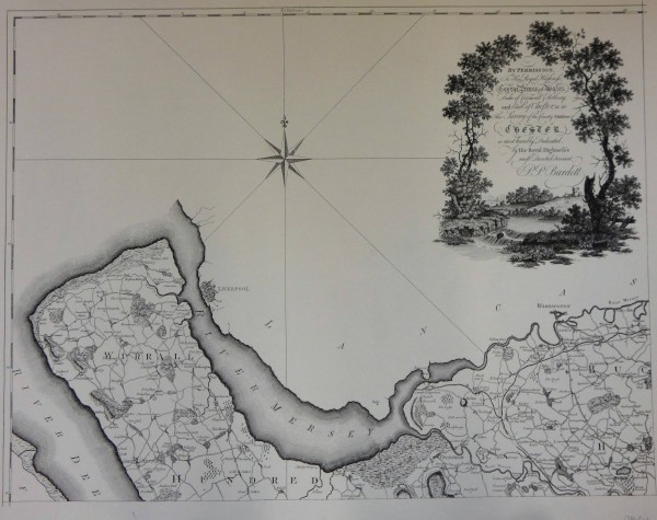
Survey of the County Palatine of Chester
Description
Shropshire Union Canal/ map/ survey of the county Palatine of Chester/ + 2 copies
Map showing the Northen part of the county of Chester, divided into Hundreds, with the Wirral and the rivers Dee and Mersey on the left, with Liverpool but no detail of the bordering Lancaster to the North, a compass star and a dedication to George, Prince of Wales set in a view of a castle at the edge of a river, framed by trees. Produced by the historic society of Lancashire and Cheshire in 1974. The original is in the British Museum with a date of 1735-1789.
Date
1735-1789
Reference code
981.0542
Extent & medium
68mm x 86mm
Print


